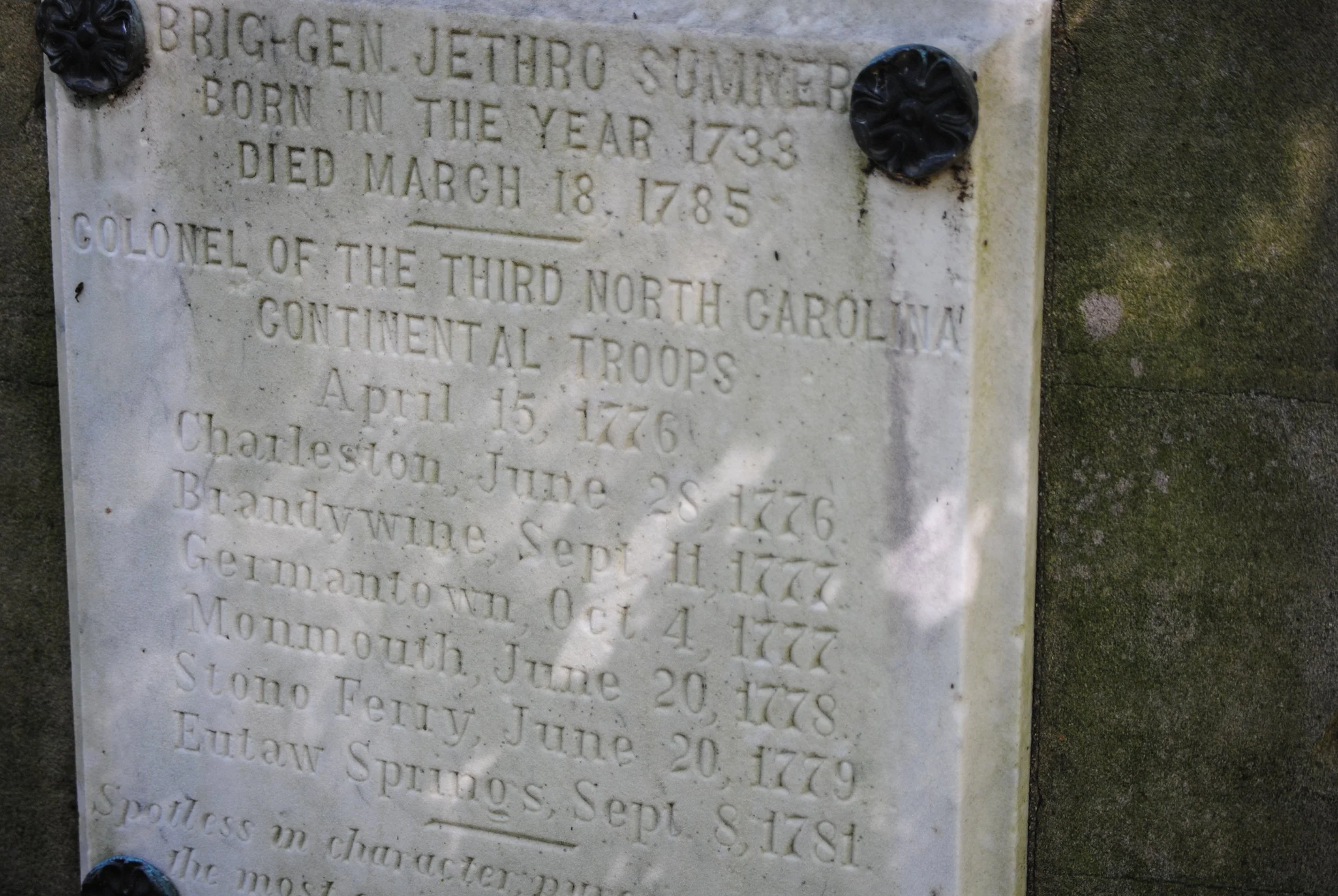
The Jonathan Jessop Map of Guilford Courthouse
The lore of the Battle of Guilford Courthouse is rich with maps. Maps of all sorts, and all qualities, populate the stories and literature of the battle. One of the most interesting, and most curious, is the “Copy of Sketch of New Garden Quaker Community Guilford Co. North Carolina Time of Battle of Guilford Court House, March 15, 1781.” The most curious aspect is the author, shown on the map as Jonathan Jessop, son of Thomas, age 10.
Jonathan Jessop (1770–1857) was a fully-fledged historical character. He moved north to seek his fortune, settling in York, Pennsylvania, where he worked as a clockmaker, horticulturalist, and supervisor on the Baltimore & Ohio Railroad. One claim to fame was his development of the York Imperial variety of apples, a personal favorite of mine. The Jessop family, also spelled Jessup, is strongly associated with the community of Jessup, Maryland, named, according to one version, for a nearby railroad cut whose work was supervised by Jonathan Jessop.
Jessop grew up in the Quaker community that arose around the New Garden Friends meeting house. On the morning of 15 March 1781, the New Garden community was rocked with the first shots fired in the engagement at Guilford Courthouse. Henry “Light-Horse Harry” Lee and his frequent adversary, British lieutenant colonel Banastre Tarleton, skirmished and maneuvered in what historian Algie Newlin termed “The Battle of New Garden.”
Jessop’s map shows the family house directly on the road from the New Garden meeting house to Guilford Courthouse. The fighting at New Garden had two important engagements, one at the meeting house, the other, “The Clash in the Lane,” took place on Historic New Garden Road, and according to the map, directly in front of the Jessop house.
Something spurred Jonathan to record the remarkable events of the day. At some point, he committed the battle to paper, or, at least part of the battle. His focus was on the fighting at New Garden, which occupies the vast center space in the map. The actual battle of Guilford Courthouse was relegated to the upper right corner, a footnote in what he saw as the main point of his story.
The Jessop map has gained prominence for one unique feature. The battlefield maps of Guilford Courthouse make no mention of Hunting Creek. John Hiatt, in his monumental work on the battlefield, correctly noted that if the creek had figured on any of the maps, this fact would have ended any debate on the location of the third line of battle. Unique among the eighteenth-century maps of the field, the Jessop map shows a creek in the upper right corner. Many, tantalized by the idea, have tendered the idea that Jessop drew Hunting Creek, and in doing so cemented its place in the battlefield.
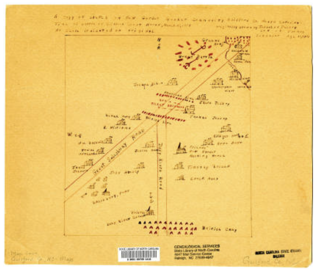
Tantalizing, perhaps, but the reality fell far short. The map shows a stream, labeled “creek” in the far right corner. On the right of the creek, “Green’s Army,” and on the left, “Great Battle.” It seems obvious the stream is Horsepen Creek, which marked the initial deployments of the opposing forces. As depicted on the map, Greene’s army lined up behind Horsepen Creek. The Jessop map has joined all the other contemporary maps in missing Hunting Creek.
Even so, much of the Jessop map raises questions, all screaming a lack of reliability. Fundamentally: do we really think a ten-year-old boy was allowed so close to the fighting at Guilford Courthouse that he could map it? Hopefully not. The fighting in “the Lane” was an exception: it occurred in his front yard. The main battle was far distant, and a boy had no ability to travel to the battleground and observe the fighting in safety. In all fairness, the map almost certainly shows matters the boy inferred or heard from others.
There are other problems. The maps says it is a copy of a sketch by Jonathan Jessop. What happened to the original? We have no way to know. The map says the map was originally drawn by Jonathan Jessop, but in this light, says nothing about who drew the copy. The best case for the map is that it is a copy, of unknown date, by an unknown scribe, of a map purportedly drawn by a ten-year-old child of something he could not have witnessed. While we may take it at face value the map was accurate in its date of 1781, there is no proof of any sort this was the case.
The map’s provenance is obscure. It surfaced in an article in the Greensboro Record of 23 May 1946. The map is now housed in the state archive’s North Carolina Digital Collections.
With all this said, I still enjoy looking at the Jessop map. Maybe because it is a link to my favorite apples. Maybe because of its tantalizing brush with finally locating Hunting Creek. Either way, it is worth a look.